Wednesday, May 25, 2011

Bahamas to Florida to Beaufort, NC

Beaufort, North Carolina
34 42.90 N 076 39.80 W
(Click on each photo to enlarge)

Back in the USA

Dropping the Bahamas
courtesy flag after 4 months
 On Sunday May 8, after four wonderful months in the Bahamas the tattered Bahamian courtesy flag came down as we made our crossing back to the US – and it was an awesome crossing – at least in the “Admiral’s” opinion.

The gulf stream crossing was
nice and smooth for the Admiral
 We departed West End Grand Bahamas before sun rise; The Gulf Stream was like a millpond with just a gentle ocean swell. We saw very little boat traffic on the way across which was made up for upon our approach to West Palm Beach.

Culture shock arriving in West
Palm Beach on Mother's  Day
 The inlet was crazy with boats of all sizes zipping around. Peanut Island, just inside the inlet was packed with Mother’s Day Sunday afternoon boaters. We both felt sensory overload and culture shock with our US landfall. We made our way past the masses and anchored in the relatively quiet Lake Worth anchorage in North Palm Beach. Mark made the telephone call to the US Customs with our pre-registered “Local Boater Program” and we were officially cleared in to the country.

A hatching of "Love Bugs"
covered the decks of Carina
 Monday morning we weighed anchor and made our way up the ICW to Manatee Pocket in Stuart, FL. Our plan was to look at new dinghies at a marine store in town called A Sailor’s Place to purchase a new one there. Our old Zodiac with an inflatable floor is ready for retirement and will be replaced with a RIB (rigid inflatable boat). We decided on an AB aluminum hull 10.5’ with a bow locker. Unfortunately Sailor’s Place did not have that size in stock. We almost went with the smaller 9’5’ but after some debating and telephone calls Mark was able to locate the dinghy of choice in Annapolis, MD. So it will be another month of service for the Zodiac. We had a nice dinner with our friends Polly and Mo from Serenity that evening at Finz. After some provisioning and errands on Tuesday we made way for Faber Cove in Fort Pierce for the night. Aside from an invasion of nasty little love bugs it was and uneventful trip.

Wednesday May 11 we retraced our route north and met up with our friends, Rich and Carol Wellman (Manta 42 –“Great Catsby”) in Melbourne. We had a nice visit with them including a refreshing dip in the pool and dinner at their condo. Thursday was a long day – 70+ miles motoring up the ICW to Daytona. We anchored on the Halifax River around 6pm.

View from the Sprint Tower

We decided we needed a “tourist” day since we have been making such good time north so we secured dock space at the Halifax Marina on Friday morning. After some morning boat chores we called a cab and made our way over to the Daytona Speedway. We took a tour of the Speedway which was amazing.


K & M at Victory Lane
 The 1 ½ hour tram tour included the driver’s meeting room, the infield Fan Zone, the Sprint & Nationwide garages, the pits, Victory Lane and an awesome view of the entire complex from high atop the Sprint Tower.

View from the grandstands
We ended the day with dinner at a pizzeria – our 1st pizza in who knows how long. We certainly have missed the variety of restaurants and food choices available during our four months in the Bahamas - especially needing a Sushi fix. 

We made our way to a mooring ball at St. Augustine Municipal Marina on Saturday after dodging and sitting out a rather nasty front of afternoon thunderstorms along the way. Sunday 5/15 was another busy day on the ICW passing through the Jacksonville area on our way to Fernandina Beach. We had passed by this town on our way south in the fall so we decided to stop for a couple of nights. The ebb & flood currents on the Amelia River are fierce through this stretch so we picked up a mooring ball from Fernandina Harbor Marina thinking it would be a better choice than anchoring.

Fernandina Beach, FL
Monday morning was clear and sunny and we were able to see the space shuttle contrail from our boat shortly after the morning launch about 150 miles to our south. Later we enjoyed the quaint little downtown historic area of Fernandina with its many shops and restaurants and took in the Historical Museum which was very interesting. After a full day of exploring we headed back to Carina. As usual the currents were ripping through the mooring field and 15-20 kt westerly winds were blowing 90 degrees to the current so we were turning circles on the mooring ball.

Fernandina Harbor Marina with
town in behind from Carina's
mooring on the No. Amelia River
Around 6:30 PM, at near maximum flood current, we were just starting to prepare dinner (after a few afternoon cocktails mind you) when we heard a loud bang towards the bow of Carina. Mark went forward and pulled up only a short length of chain still attached to the pennant line that had been attached to our bow cleats. The mooring chain had broken and the mooring ball was already being carried away by wind & current - as was Carina. We immediately went into emergency mode – put down the wine glasses, fired up engines, maneuvered away from the other boats and notified the marina what had happened. Thankfully despite the wind and current (and alcohol) we picked up another nearby mooring ball on 1st try. 

The weak link of the
mooring ball chain
 Mark had noted when we arrived the previous day that the 3/8" chain was rusty – not too unusual – but after looking at the break point on the chain it was evident that the part hidden within the mooring ball had deteriorated to only a fraction of it's former diameter. The marina staff was very apologetic and commented that the guy they hire to maintain the moorings had just recently checked them and claimed "all were in good shape". Although we really enjoyed the town, we will think twice about picking up one of their moorings in the future. Had the mooring ball chain broken while we were in town earlier in the day we'd be sending a different version of this blog. 

The Jekyll Island Club
 Tuesday 5/17 we crossed out of Florida and into Georgia. We tied up dockside at Jekyll Harbor Marina. We made use of the marina’s loaner car to get a few groceries and then the loaner bikes to explore the historical district. This small barrier island was purchased by the state of Georgia in 1947 to preserve the fragile ecosystem – especially the dunes on the beach side. States law dictates that no more than 35% of the island can ever be developed.

The bike path along
"Millionare Row". We're
going to miss the Spanish Moss!
Up until the 1940’s the island was the playground of the rich and famous. Millionaires Village in the historic district was once the exclusive winter community of the Rockefeller, Vanderbilt, Morgan and Pulitzer. The structures fell into disrepair with the onset of the depression. The 33 original “cottages” and lavish Jekyll Island Club hotel have been restored and are now open to the public. People still play croquet on the expansive front lawn of the club.

The Goodyear (as in tires)
summer cottage on Jekyll Is.
Jekyll Island was the perfect spot to stage for an outside “hop” up the coast to avoid the winding, narrow and shallow creeks of the Georgia portion of the ICW. Also, for the next few days, the low tides were abnormally low due to the full moon phase and this would impede out transiting of several shallow sections of ICW in GA - even with our 3’8” draft.   
  
Dolphins kept us company
sailing outside up the coast
So on Wednesday morning we made our way out from Brunswick, GA through St Simon’s Channel to the Atlantic. We sailed with following seas in winds of 8-16 kts. for over 21 hours – a good portion of sailing wing-on-wing (jib out to one side, main sail out to other to capture most wind from astern boat) with an almost full moon the entire night. We saw no other cruising boats and only had to dodge 2 large cargo ships that crossed our heading around 11pm. But we weren’t alone as we had several pods of dolphins join us at various times. They entertained us with their antics while swimming along side and between the bows.

Arriving in Charleston Harbor
in AM abeam of Fort Sumter.
 We entered the Charleston Harbor breakwater before 8am and dropped sails alongside Fort Sumter. After motoring a short way up the ICW to Dewee’s Creek we dropped anchor, showered and had a nice brunch complete with Bloody Marys before a well deserved nap. Although Kathy does not enjoy overnight passages we shaved a hefty 229 statute miles off the ICW trip and we’re more than halfway to Norfolk, VA.

Anchored in Dewee's Creek
10 miles north of Charleston Hbr.
 Friday May 20 (Mark’s Birthday) we awoke fully recovered from the (sleep deprived)overnight sail and made way for another familiar anchorage behind Butler Island.

Sunrise over Dewee's Island
 On this stretch the love bugs have gone only to be replaced by even nastier green headed horseflies. Thankfully they left us once we anchored.

Ospreys like to build their nests
in the ICW channel marker posts
The trip up through the wild and unspoiled Waccamaw River was much more picturesque at this time of the year as compared to when we passed this way last fall.
 Saturday was another busy weekend on the ICW with PWCs and small power boats as we made our way to past Myrtle Beach anchoring at the mouth of Calabash Creek just south of the North Carolina border.
Kathy taking in the view of
the Waccamaw River 


The waterfront docks at
Beaufort, NC
Yesterday, Tuesday 5/24 we arrived in Beaufort (pronounced Bo-furt), NC and tied up at Beaufort Docks. Beaufort, NC is supposedly a must see for ICW traveler’s and we have always bypassed it until now. The marina docks are right in the heart of the downtown historic district with numerous shops, restaurants and museums. So once again we will be playing tourist and do some sightseeing …after the boat is washed and this blog is written.


Saturday, May 7, 2011

Northern Abacos to West End, Grand Bahamas

West End, Grand Bahamas
26 42.05 N 078 59.52 W
(click on each photo to enlarge)

Today is Saturday 5/7/11 and we are underway motor sailing from Great Sale Cay in the Northern Abacos to West End, Grand Bahamas. We plan to cross the Gulf Stream and be back in the USA tomorrow afternoon. We thought we should post one more blog since it has been awhile.

Since our last post on Tue 4/19/11, we ended up staying in Fisher’s Bay on Great Guana Cay for a total of 8 days. Our anchor was dug into a sand patch quite well. We had great internet from the boat, and great swimming in a small patch reef about 300’ behind the boat.

We were not in any hurry to stray too far from Marsh Harbor while we waited for a replacement sea water pump being shipped in from the US. On Tues 26th we motored 7 miles back to Marsh Harbor, returning to Mangoes Marina where the part had arrived. Replacing the pump was quite easy but Mark did need to borrow the marina bicycle to go to a garage in town to have a gear pulled off of the old pump shaft to install on the new one. We were back in business in no time. We did a little more provisioning that afternoon knowing it was probably our last chance to visit a real grocery store until we get back in Florida.

Treasure Cay Beach
On Thu 4/28/11 we left Marsh harbor and had a nice down wind sail to Treasure Cay. We anchored in a protected little basin off the Treasure Cay Resort marina. As luck would have it they were hosting a sport fishing tournament which we figured out as we watched a procession of about 30+ large sport fishing boats (60’-75’ Hatteras types) made their way into the harbor between 4 -5pm. We awoke the next morning to the wakes of the same boats leaving for another day of fishing. There is a gorgeous white sand beach on the Sea of Abaco which is said to be one of the top 10 beaches in the Caribbean. We enjoyed afternoon Margaritas at the marina pool which is open to cruiser’s anchored in the harbor.

Kathy "phoning home"
from the only pay
phone on Green Turtle cay
On Sat 4/30/11 we traveled from Treasure Cay to Green Turtle Cay. The Sea of Abaco in this area is too shallow, with shifting sand bores, for all but smaller boats to navigate. To get to Green Turtle you must travel back out through one channel into the ocean pass and around Whale Cay before re-entering  the Sea of Abaco through Whale Cay Cut. You need to pick a weather window through this area carefully avoiding any large seas or winds from the north as it can produce breaking waves in the cut called a Rage.


Serenity giving us a farewell pass as
they depart the anchorage FL bound.

All the Cays to the north and west of Whale Cay are considered the Northern Abaco island chain. We picked a calm day to travel to Green Turtle, arriving by lunch and anchored in White Sound at the north end of the island. Our friends, Mo and Polly on Serenity were at the Bluff House Marina and we enjoyed a Bon Voyage dinner with them on Sunday night – they left  on Monday bound for Florida by (this past)Wednesday.

The goverment dock of New Plymouth
We spent a few days exploring Green Turtle by foot and dinghy as usual. Black Sound is the southern anchorage which we explored by dinghy. New Plymouth in Settlement Harbor is the main town on the island. With pastel colored houses, picket fences and cut coral stone walls it reminds you of a quaint New England fishing village. In fact the town is “sister city” to none other than Key West, FL.


Bronze busts of notable Bahamians
in the Memorial Garden
 Some homes were actually disassembled and moved to Key West after one of the hurricanes came through the area some years back. We visited the museum, the Memorial Sculpture Garden and their 200 year old cemetery.
Lunch at Pineapple's


Kayaking at Manjack Cay. Carina
anchored behind Kathy.
  Mark has been looking to replace our existing dinghy now for some time with a new rigid inflatable boat (RIB). The air floor developed a slow leak sometime around February that needs re-inflating every 5 days or so. It could have been repaired once we get back to the states but it was the final excuse for us to upgrade to a RIB. A dealer in Stuart FL offered the best price and availability for the RIB we were shopping for.


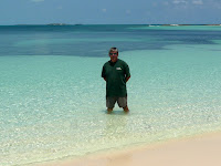
We're going to miss these
crystal clear waters. Darker
water behind is grasssy bottom.
  Going to Stuart drastically changed our itinerary and intended landfall in Florida as we had intended making our way much further north. So that brings us to where we are now. We were looking at a favorable weather window for crossing the “Stream” in the Saturday to Monday timeframe.

At Miss Emily's Blue Bee Bar.
Claim to fame originator of the
Goombay Smash Drink
 With that in mind, on Tue 5/3 we moved from Green Turtle to Manjack Cay just 5 miles away. Manjack is home to lovely beaches, coves, hiking trails and a couple of wrecks and shallow reefs for snorkeling. There are only a few homes on the island and no services. We had a great two days of swimming, hiking and kayaking before moving along to stage for the crossing.

We left Manjack Cay on Thursday, 5/5, bound for Crab Cay off Angelfish Point which is the northernmost point on Great Abaco Island. From this point it’s all west-bound. The Sea of Abaco becomes the Little Bahama Banks extending west 100 miles to The Straits of Florida.

Old Bahama Bay Marina L
 On Friday, 5/6 we made our way 40 miles to Great Sale Cay which is the jumping off point for many boats enroute to the mainland US. We shared the anchorage with 8 other boats all of which departed shortly before of after dawn.

Old Bahama Bay Marina R
We raised anchor around 7am and arrived at our final port of call in the BahamasWest End, Grand Bahamas by 2:30PM.


Reality Check for us Americans:
Bank in Green Turtle Cay open 2 days a week for 4 hours/day.
Fuel at Guana Cay is $5.95 cash, $6.25 credit card / gallon.